Developments & brands we've visualized



Three products that let buyers, brokers, lenders and partners see a property years before it's built — flown, not imagined.
The real view from every unit — off the balcony or through the window — flown at its true height.
Try the simulator › 02The finished building rendered into real drone footage of the real site.
Watch it in motion › 03Exact parcel boundaries drawn and tracked over live aerials, labeled per lot.
See the lot work ›Developments & brands we've visualized
A drone flown to the exact height and position of every future residence — off the balcony, or from where the living-room window will be. Both towers at One Beverly Hills are below — drag either one. Every level flown.
For towers, mixed-use and multifamily in pre-sales — sales galleries, offering memoranda, unit-by-unit pricing you can defend.
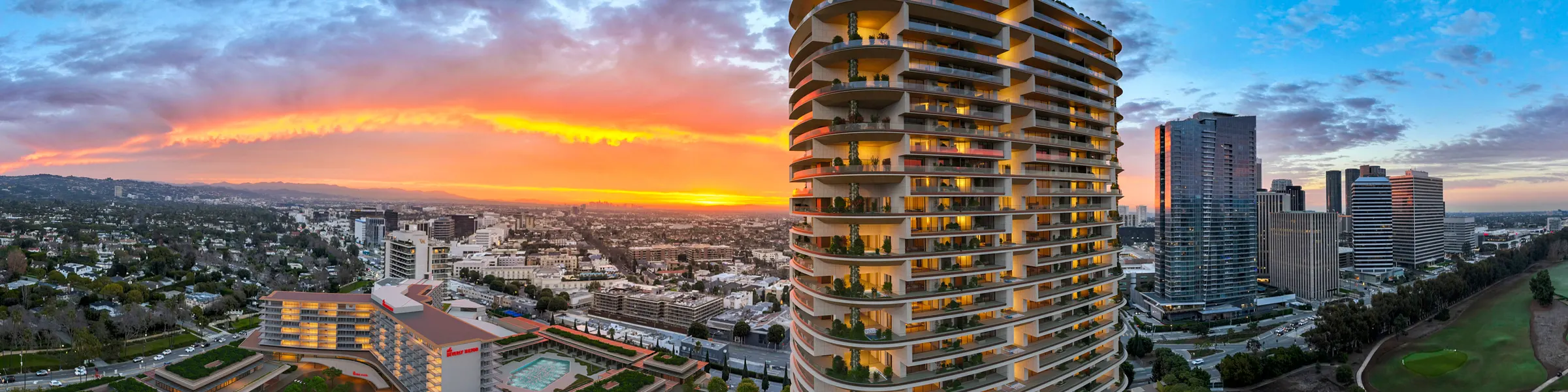
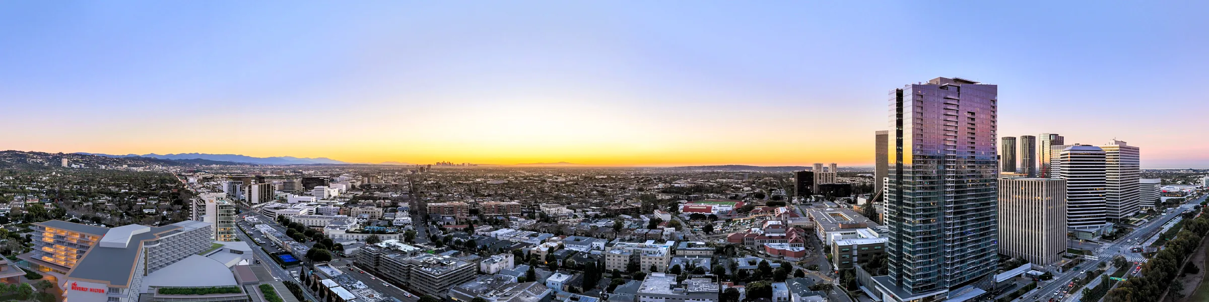
Actual client deliverables — both towers at One Beverly Hills, each flown at the true elevation of every floor line.
The architectural model rendered photoreal and match-moved into 4K drone film of the actual site. True light, true scale, true surroundings.
For launch campaigns, capital raises, entitlement and community presentations — anywhere the building has to look real before it is.
Six Senses — Camp Korongo, Kanab, Utah. The unbuilt lodge tracked onto the real mesa across moving 4K aerials.
Drag the handle. The same mesa, with and without the lodge. Everything behind the building is real.
Amancaya, Children's Bay Cay — a 12-second approach, with and without the villa. Here the plate underneath is the color-graded footage the render was built on.
No 3D model — just truth. Exact boundaries drawn and tracked over real aerial film, labeled per lot and matched to the developer's masterplan.
For land and lot sales, masterplans and resort parcels — plus brokers, lenders and JV partners who need to read a site without flying to it.
Straight-on boundary passes, labeled per lot, across Children's Bay Cay and Williams Cay.
A full rotation shot from the center of each property — buyers see their exact outlook.
Property outlines shaded onto the mesa across the residence lots — the same program adapted to canyon terrain.
Lot 11 outlined and named in the shot, holding to the land as the drone moves — one of twelve lot films.
Aman's own delivery spec, and the template we run everywhere else.
Coverage is the product. Not a few hero angles — a view for every residence, a boundary for every lot. Three numbers worth remembering, then the record behind them.
The record behind those numbers
Every residence in both towers
Every parcel, a full 360° from the center of each
Every residence lot, three passes deep on each
Every lot outlined and named in the shot
One unbuilt lodge, tracked onto real moving aerials
Plus Mandarin Oriental and further resort, hospitality and development work across seven continents.
FAA-certified, with commercial drone authorizations secured internationally — we handle the permitting and the logistics.
Tell us where you're building and which of the three you need. We'll come back with what your buyers would see, and what it costs.
Thanks — your note is in. We'll come back to you shortly, usually the same day.